[flickr size=”center” float=”medium”]http://www.flickr.com/photos/motorbeam/33700247701/[/flickr]
The beauty of the various places in Uttarakhand is completely vivid
We couldn’t stop for long so we kept moving and enjoying the road as we reached Srinagar. Srinagar is more of a checkpoint for people travelling to Badrinath, Kedarnath or some similar holy place as the roads connect and pass via Srinagar. Another free stay was arranged for us by a friend and we had the cheapest and the tastiest dinner ever in a local Dhaba. We had a good sleep, breakfast at the same Dhaba and our next destination was Joshimath. This time, the major intersections were ‘Prayags’. Places like Rudraprayag, Karanprayag, Nandprayag are the municipal boards from the Panchprayag list. These Prayags are the places where two or more rivers meet and flow into a new river. These sightings were just as beautiful as it could get. Also these were the only places where a car as good as the Honda BR-V could have been spotted.
[flickr size=”center” float=”medium”]http://www.flickr.com/photos/motorbeam/33700247441/[/flickr]
Passing by a small village where the Honda BR-V looks bigger than the houses
The stretch to Joshimath was amazing and the Honda BR-V was just flying, taking corners and going really fast on the straights. We reached almost an hour earlier than the estimated time by Google Maps. We had our stay at a government guest house as that was the only place with good parking but getting into that parking area was a task as the long length of the BR-V made me worry. The main purpose to visit Joshimath was to visit Auli, a place which goes above 3000 meters above sea level and there’s a good amount of snow from the month of November to February. Though it has snowed less, we did enjoy playing and also learnt some skiing there. The next day were the Uttarakhand elections and no one was allowed to move out or drive around for the day so we wrapped up our plans and moved towards Dewal, a small village on the way to Roopkund lake.
[flickr size=”center” float=”medium”]http://www.flickr.com/photos/motorbeam/33788363676/[/flickr]
Taking on such roads was a piece of cake for the Honda BR-V
The loose soil mountains are the reason Uttarakhand gets such a beautiful landscape everywhere you see
This journey was back to two of the Prayags that split towards the north-east. The roads till Karanprayag were beautiful but as we split to a different route, the roads worsened out. The Uttarakhand road widening project led to almost 20 kms of loose soil road with a bit of tarmac patches in between. This time we went rally mode for about 2 kms and the BR-V took all the beating without any issues and I could hear the engine roaring for more fun. But as driving fast on unknown as well as bad roads is risky, we took a tea break at a landslide before us. After the gruelling 20 kms, the last stretch of 35 kms was full of blind twisties and a single lane nicely laid tarmac road going through various villages. Yet again we reached our destination Dewal at sunset, about 45 minutes earlier than the estimated time.
[flickr size=”center” float=”medium”]http://www.flickr.com/photos/motorbeam/33788361476/[/flickr]
A local Prayag where two different rivers meet
We were welcomed at our colleague’s house and he had worked out a parking space especially for this Japanese car. The next three days we spent in Dewal for our colleague’s wedding. We did visit a drop off place called Wan which is the base camp for Roopkund lake trek which goes on for five days. During the wedding, the Honda BR-V was the best car of the lot and without any doubt it was the car that the Dulha (our colleague – the Bridegroom) would arrive in and take the Bride back home. After the three days of enjoyment, the final travel destination was Nainital. This was the slowest and the longest time we travelled as we didn’t drive for almost three days and we had to get sweets and collectives on the way back for home. We reached Nainital pretty late and I noticed our beautiful white Honda BR-V had turned dusty brown with slush and mud all along.
[flickr size=”center” float=”medium”]http://www.flickr.com/photos/motorbeam/33700245301/[/flickr]
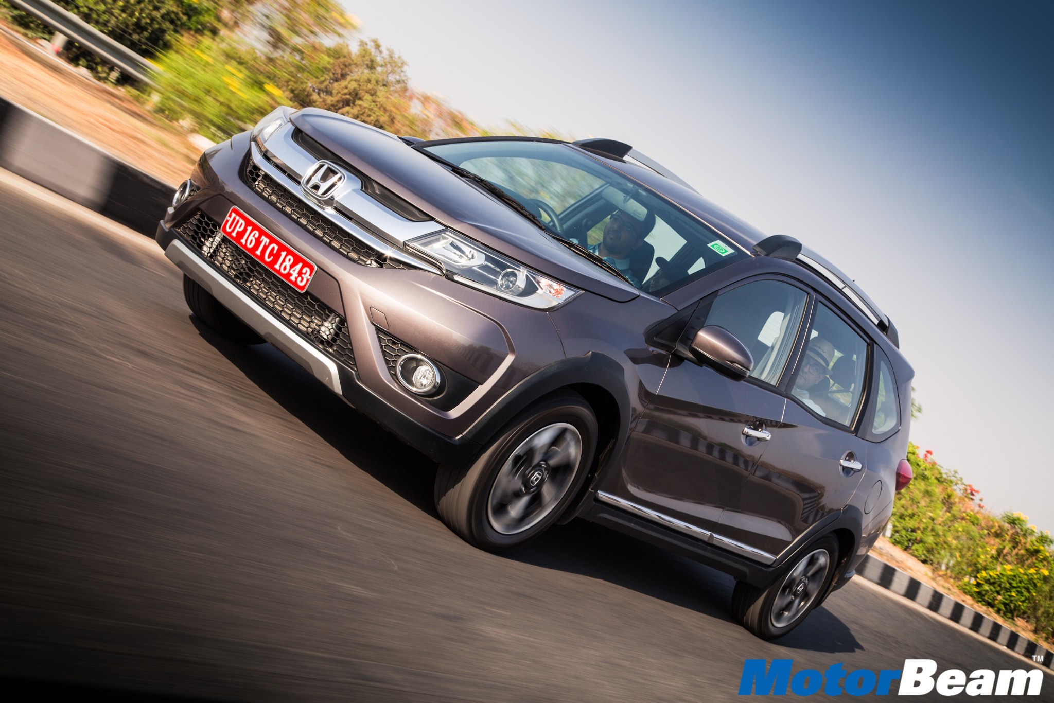
The Honda BR-V does have some body roll because of its size
The amount of bad roads, the numerous gradients and the tight corners, there was never a spot where I got scared that the car would lose control. Even after being an MPV, it felt and drove like a hatchback except for the weight, it was sorted all the time. The time we reached Nainital, we had missed about four routes and we got really late. There are various lakes called as ‘Tals’ near Nainital which led to the confusion. Within Nainital, we drove around the Mall road, had our dinner, chilled out at the lake and got down to a hotel for our night stay. The hotels were so clumsy and gladly the BR-V was just wide enough to enter the tight entrance and the small but secured parking space. If we had any bigger vehicle, we would have had to park outside. This was the last hill-station on our list and the next day we had a flight back from Delhi.
[flickr size=”center” float=”medium”]http://www.flickr.com/photos/motorbeam/33016027573/[/flickr]
Thin and long trees are a sign it snows a lot in some places of Uttarakhand
The roads to Delhi from Nainital go via Haldwani-Rampur-Ghaziabad. There is downhill till Haldwani post which a long highway till Rampur. Post Rampur we were flying on the Delhi-Rampur highway and the Honda BR-V was sitting tight at 140 km/hr without a hick-up. This was the time where the steering stayed straight for a long time and we did engage it into top gear. In no time we were crossing Ghaziabad with a happy face yet a sad heart as we were going to miss Uttarakhand and the amazing people that make the place worth visiting. This trip to Uttarakhand was a mixture of planned-unplanned trip. We did reach Uttarakhand but visiting and travelling places within was spot-on and it was an amazing driving experience with the capable Honda BR-V.
[flickr size=”center” float=”medium”]http://www.flickr.com/photos/motorbeam/33700244351/[/flickr]
The snow peak in the top-right corner is one of the mountains of the Himalayas
Pages: 1 2